por Phil Bartle
traducción de Lourdes Sada
|
por Phil Bartle traducción de Lourdes Sada |
|
|
.
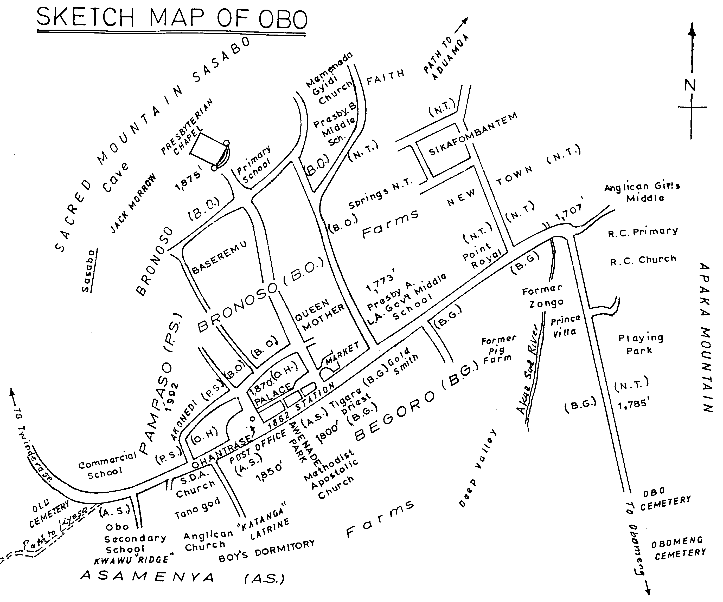
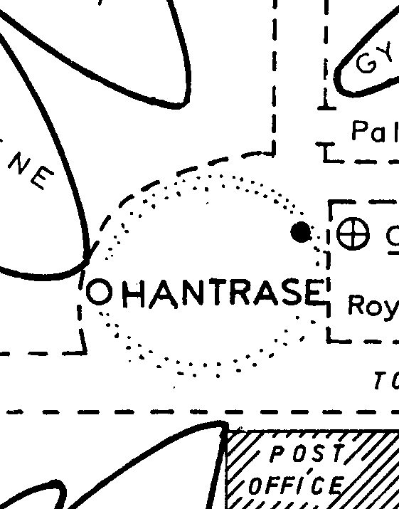
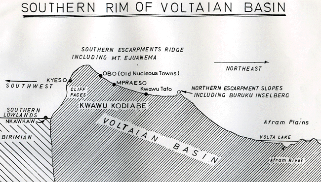
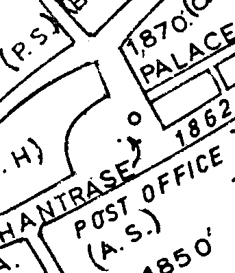
The names above with two letter initials, eg A.S. Asamenya, are census districts. Houses are marked with those two letters followed by a number. Other names on the map are local names. Ohantrase, for example, means under the sacred Ohantra tree, in the traditional political and religious centre of Obo, outside the chief's palace. Sikafoambantem literally means "the rich people came late." It refers to a new neighbourhood (N.T.) where millionaires have built many extravagant mansions. Baseremu means the place of Basel, where the Presbyterian church is, the land given to the Basel Mission in the nineteenth century. At the end of World War I, the British colonial officials took the congregation away from the Swiss Pietists and gave it to the Church of Scotland. They kept all the administrative functions, such as postal services, roads, for themselves. Faith is an area also called Memenada Gyidi, Saturday Faith, which was the name given to the Seventh Day Adventists.
|